|
|
The Green And Rathbeale Road Swords
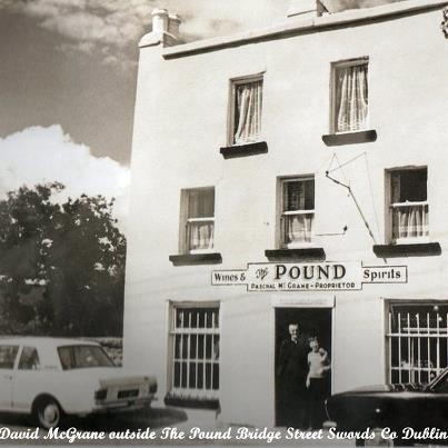
The turn to the left at the end of the Main Street, leads to Go. Meath. The first part of this road is called the Pound,
because in the yard of the public house, stray animals were impounded by the local Police. But the area along this road is
called The Green
The right side of this road is flanked by the Old Castle, an interesting well preserved ruins once the residence of the Norman Bishop, John Coriyrn. To the left, beyond Byrnes public
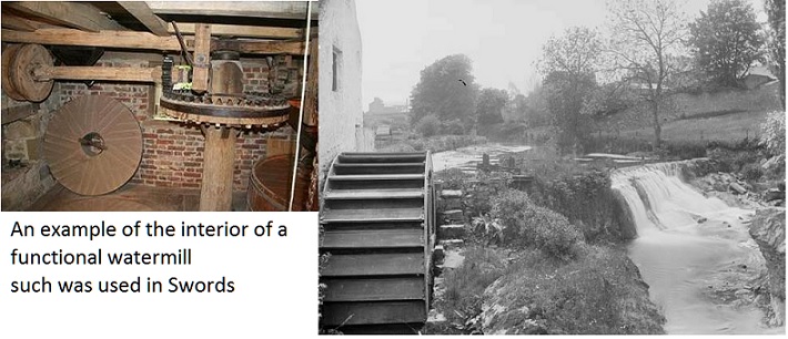
house, which is built against the Castle wall, was situated Penton, till. The watermill was working up to about the beginning
of the First World War, 1914 - 1918. It was a small mill but it crushed oats and made wheaten meal for the farmers of the
district.
The bridge across the river had very nice views up and dozm stream. The upstream view was very nice. The old mill was
on the left with a pretty weir about 20 ft. high which spilled its silvery waters under the bridge in a musical surge. The
mill race above the weir was flanked with gardens and trees. And in the foreground, just between the bridge and the weir,
there was a cottage, surrounded with a lovely row of lombardy poplar trees. The downstream view was quite different.
The rush of water under the bridge dashed over rocks protruding from the river bed and a green park flanking the battlement
walls of the Old Castle made a frame for the winding river.
On the other side there was a row of thatched cottages built on a high bank above the stream and behind them was a sloping
green which was a playground for all the boys and girls, called the Rock Garden. The road sloped above the bridge and rows
of thatched cottages filled the distant view to the left and right.
Re.-Rosemary Lane runs left before the turn for Watery Lane into St. Columba's Estate. M.D.
|
|||||||||||||||||||||||
|
Next Page A History Of Swords - Politics
|
|||||||||||||||||||||||